ISBN: 9781776170531 | Published: October 1, 2022 |
Road Atlas: South Africa 28th Edition
Road Atlas: South Africa 28th Edition
Cannot be ordered — this title is out of print
Couldn't load pickup availability
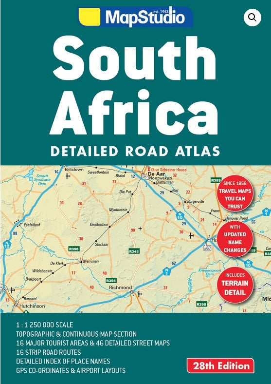
• Updated Place name changes
• Includes satellite towns
• Terrain detail (topography)
• GPS co-ordinates at major road junctions
• 34 page continuous map section
• Scale of 1 : 1 250 000
• Tourist Regions, 16 detailed maps covering:
Cape Peninsula, South-Western Cape, Overberg, Garden Route, Eastern Cape, Kwa-Zulu Natal coastline, Drakensburg, Midlands Meander,
Kwa-Zulu Natal Battlefields, St. Lucia (iSimangaliso), uMfolozi Hluhluwe region, Gauteng Region, Magaliesburg, Sun City, Pilanesberg & Kruger National Park.
• 46 detailed Street Maps of:
Bhisho, Bloemfontein, Cape Town, Durban, East London, George, Gqeberha (Port Elizabeth), Hartbeespoort, Johannesburg ‘ring road’ & Central, Kimberly, Klerksdorp, Knysna, Kroonstad, Ladysmith, Langebaan, Mafikeng, Makhanda (Grahamstown), Margate, Midrand, Mossel Bay, Mthatha, Nelspruit, Oudtshoorn, Phalaborwa, Plettenberg Bay, Polokwane, Port Alfred, Potchefstroom, Pretoria, Richards Bay,
Rosebank (Jhb), Rustenberg, Sandton (Jhb), Simonstown, Stellenbosch, Swellendam, Ulundi, Upington, Welkom, White River, Witbank (Emalahleni) & Worcester.
• 3 Airport layouts of O.R. Tambo, King Shaka and Cape Town
• 16 accurate and easy-to-use strip planning maps
Author Map Studio
Share